AAtlantic County Commissioner Redistricting Commission
Atlantic County Commissioner Redistricting Commission
County Office Building
Name, QPA
1333 Atlantic Avenue, 6th Floor
Atlantic City, NJ 08401
Phone: (609) 343-2268
Fax: (609) 343-2193
Questions/Comments?
Email the Public Information Officer - pio@atlantic-county.org
or use our contact form.
(Graphical Approximation)
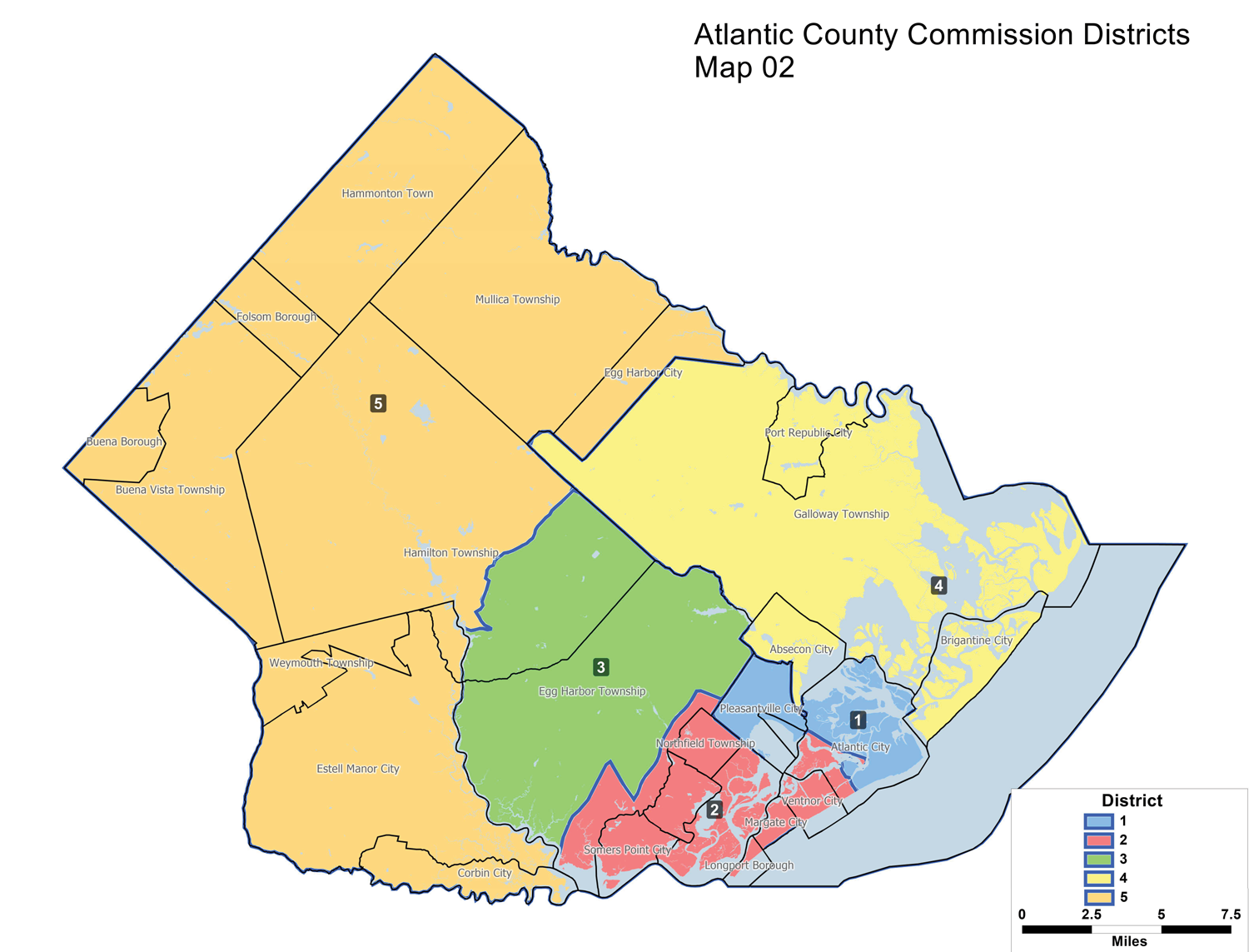
Description
- It reflects the recent rewarding of Ward 6 in Atlantic City that has already taken place.
- Hamilton Election District 8 is removed from District 3 and included in District 5 (approximately 1539 voters).
- Egg Harbor Township Election District 8 is removed from District 3 and included in District 2 (approximately 2031 voters).
- This plan only impacts approximately 3,570 total voters, making the necessary adjustments to address slight population shifts in the county over the past 10 years.
DISCLAIMER
This map is for demonstration purposes only and was not developed in accordance with National Map Accuracy Standards. Any use of this product with respect to accuracy and precision shall be the sole responsibility
of the user. The map was developed, in part, using New Jersey Department of Environmental Protection Geographic Information System (GIS) digital data, in conjunction with the Atlantic County Office of Geographic Information
Systems, but this secondary product has not been verified by NJDEP and is not state authorized.
The geodetic accuracy and precision of the GIS data contained in this map has not been developed nor verified by a professional licensed land surveyor and shall not be nor is intended to be used in matters requiring delineation and location of true round horizontal and/or vertical controls.